|
1
|
|
|
2
|
|
|
3
|
|
|
4
|
|
|
5
|
|
|
6
|
|
|
7
|
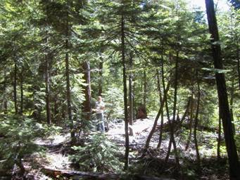
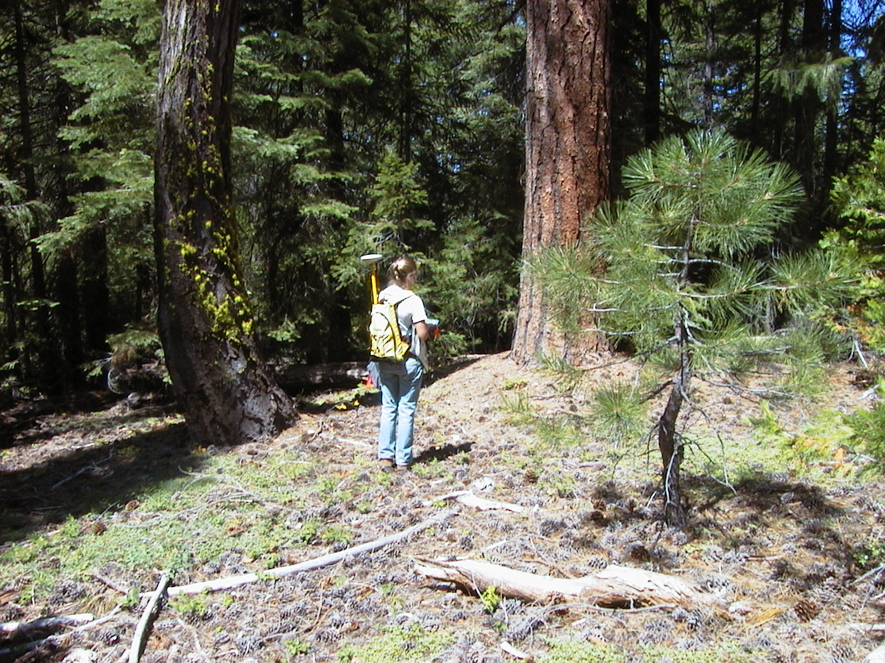
- Plots in 2005
- Focus in steep canyons & ridges of TU 2
- 224 new plots
- Implemented hurricane antenna with GPS for higher precision
|
|
8
|
- High Variation:
- Topography
- Vegetation type & condition
- Potential fire behavior
- Owl habitat quality
- Owl population density
|
|
9
|
|
|
10
|
- Inventory attributes of all trees, fuels, etc. in area equivalent to
25ha (62ac)
- 12,449 trees thicker than 10cm (4 inches)
- Stocking density: 585/ha (234/ac)
- Basal area: 48.0m2/ha (207 ft2/ac)
|
|
11
|
|
|
12
|
|
|
13
|
|
|
14
|
|
|
15
|
- Goal: constrain & systematize observations
- Take quantitative data
- Bridge to Lidar methods
- Western Journal of Applied Forestry (accepted)
|
|
16
|
|
|
17
|
|
|
18
|
- Image acquisition 2 years, overlap in TU3
- Orthorectification
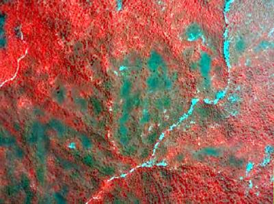
- Create NDVI
- Filter to SpECDA & other interpreted layers
- Export
- Share with team
|
|
19
|
|
|
20
|
|
|
21
|
|
|
22
|
|
|
23
|
|
|
24
|
|
|
25
|
- Fuel models tied to Vestra vegetation polygons
- Ready for intial modeling
- Coordinating fire parameter
modeling discussion with local expertise (April 2006; Jason Moghaddas)
- Suppression levels
- Ignition coverage
- Response variables for behavior and effects
- Improvements: link fuel samples from our plots to Vestra polygons
- Create finer grain fuels and forest structure coverage (fuel models
& fuel loads) using IKONOS imagery interpretation
|
|
26
|
- Weather scenarios:
- 70th percentile (moderate)
- 97th percentile (extreme)
- Comparisons
- Pre- and post-treatment
- Different treatment options: DFPZs, Group Selections, conceptual SPLATs
- Comparison of DFPZ approach and SPLATs
- Equivalent management intensity (area)
- Iterations: Scaling up management intensity (extent treated) to find
thresholds for reducing size and severity of fire
|
|
27
|
|
|
28
|
- Severity: Mortality of trees by size class and species—(e.g., how
do oaks fare?)
- Direct severity: ratio of the area of canopy fire to total fire
- Post-fire severity at landscape scale: % of forest with canopy kill
(reduction in canopy cover by size class)
|
|
29
|
|
|
30
|
|
|
31
|
- Tom Ford in Washington: coupling owls and fire
- Sessions integrated planning
- Wildlife habitat relationships
- Bahro’s Fireshed approach
- CWHR approach to assessing habitat
|
|
32
|
|
|
33
|
|
|
34
|
- Deliver SpECDA coverage to Keane’s Spotted Owl Team by May 20,
2006
- Deliver forest “landscape” (spatial description of forest
structure and composition by July 31
- Work on integrated analysis & paper in autumn
|
|
35
|
|
|
36
|
|
|
37
|
- Two field workers, including rehiring a former field tech as field crew
leader
- Focus on
- resampling subsets of ’03-05 data for consistency analysis
- Random sampling across TU 2-4
(background data separate from stratified random)
|
|
38
|
|
|
39
|
|
|
40
|
|
|
41
|
|
|
42
|
|
|
43
|
|
|
44
|
|
|
45
|
|
|
46
|
|
|
47
|
|
|
48
|
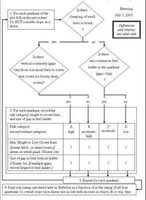
- Ladder fuel hazard is a function of…
- Clumping of low aerial fuels
- Vertical continuity of fuels
- Slope (non-linear effect)
- Vegetation type
|
|
49
|
|
|
50
|
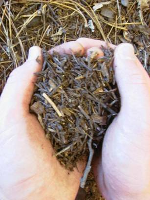
- Assess annual production of fine fuels
|
|
51
|
|
|
52
|
|
|
53
|
|
|
54
|
- 2 field crew personnel with
a part-time supervisor
- 198 new plots inventoried (TUs 2 and 3)
- 266 plots cumulative in project (68 in 2003)
- Songbird module: rapid fuel assessments at 625 sites
|
|
55
|
- 240 field plots
- 510 songbird
observation sites
- 3000 total observations: 750 plots
- A: Highest ladder hazard: 17%
- B: 2nd: 22%
- C: 3rd: 25%
- D: Lowest (4th): 36%
|
|
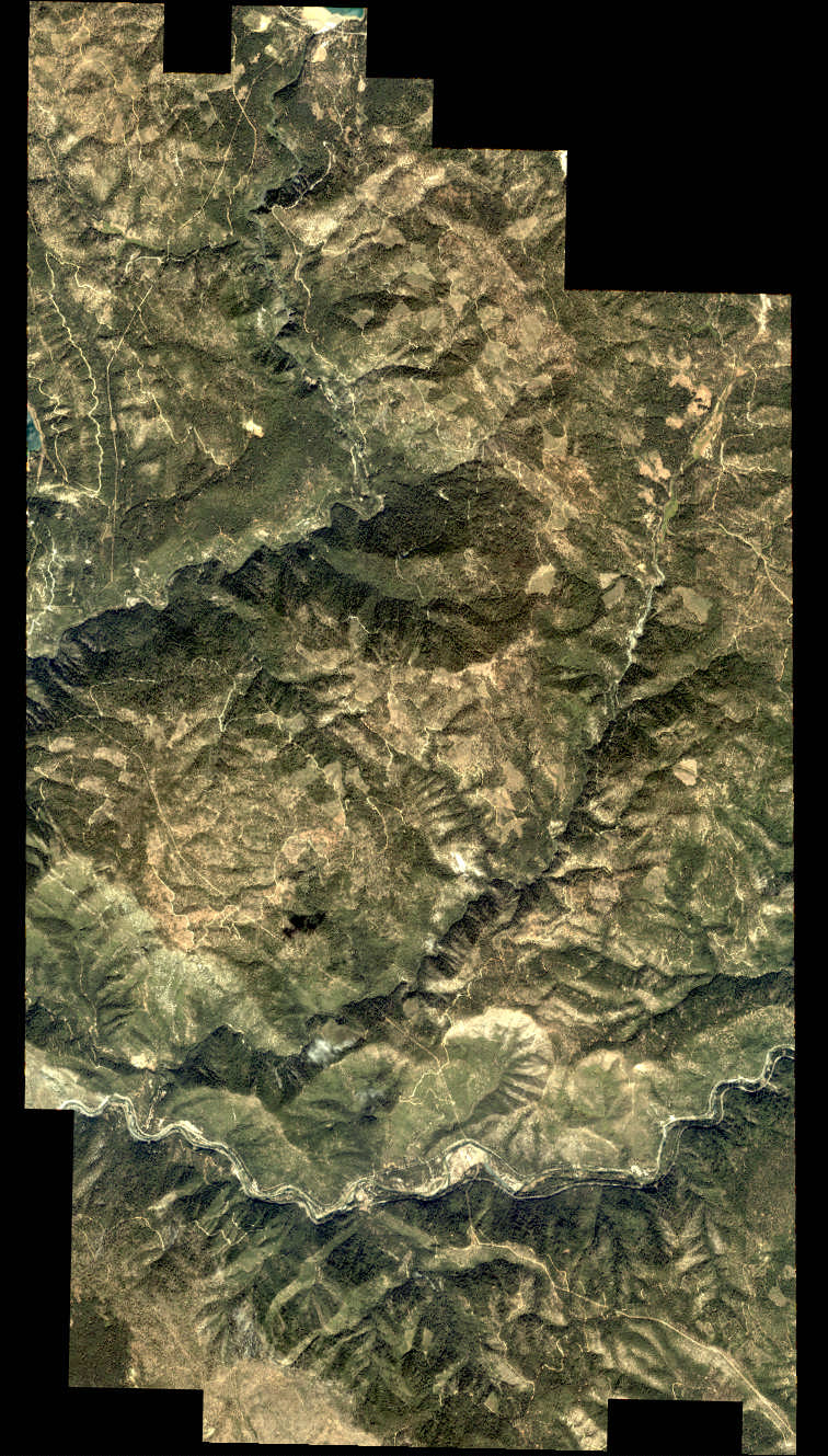
56
|
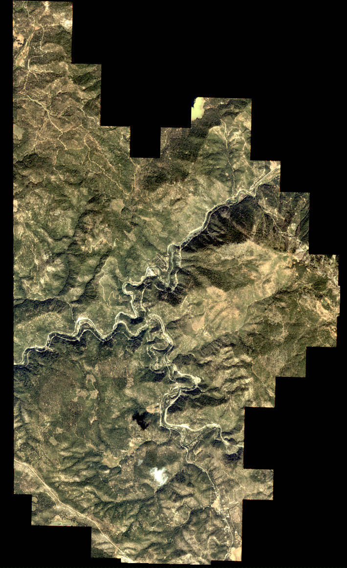
- Imagery covering
TUs 2 & 3
- Imagery overlaps imagery collected in 2003
(TUs 3 & 4)
- LANDSAT imagery will be purchased in 2005 for these areas covering the
summer of 2004
|
|
57
|
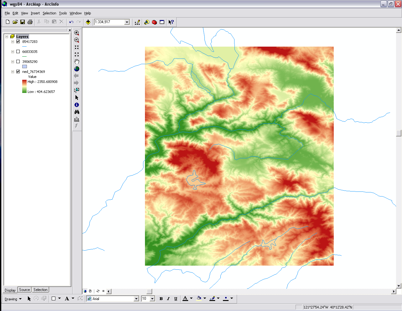
- Transfer of data to databases
- Raw field data being processed and extrapolated across the landscape
- Base layers essential inputs to all modeling efforts
|
|
58
|
- 2 person field crew & part-time supervisor
- Sample plots in
TUs 2 through 4
- Target: Additional
200 forest plots
- Hundreds more
songbird observation
sites
- Visit & learn about Cone & Cottonwood Fires
|
|
59
|
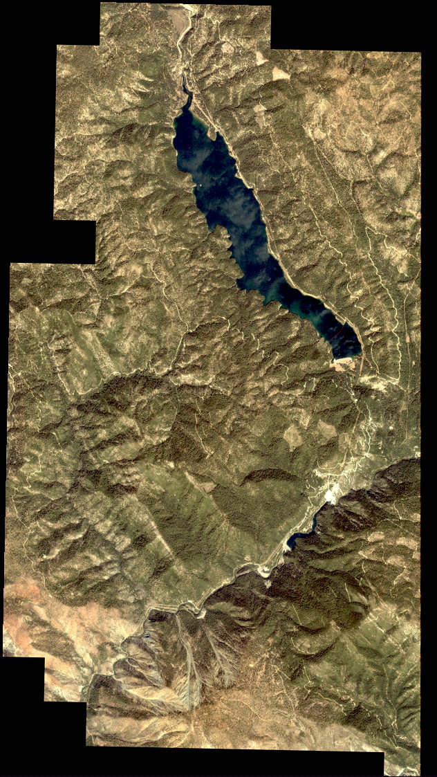
- Remote sensing merged into operational GIS
- IKONOS imagery
acquisition
- LANDSAT imagery
acquired post-field
season.
|
|
60
|
- Finalize the base layers: fuels and vegetation
- Initial runs of FARSITE and FlamMap
- Initial integrated modeling runs with owl module
|
|
61
|
|

 Notes
Notes